Description
This zip file contains several different activities (33 pages of student handouts and a PowerPoint with a total of 26 slides) which can be used to compose a unit to introduce the concepts of Coordinate Systems and Isolines. The learning objectives and specific contents of this set of materials is listed below. This set of activities is suited for many earth science, environmental science or physical science classes. With teacher guidance, many components in these materials are adaptable to an enriched middle level science curriculum.
The product addresses coordinate systems as well as latitude and longitude in depth. This package does introduce the idea of contour lines. It does not address concepts involved in topographic mapping in detail. The Topographic Map Learning Activities (High School) provides in depth activities that address that specific type of isoline. The specific learning objectives addressed by the activities in this package are listed below.
All documents are in PowerPoint, word or pdf format to allow you to edit the documents to meet your needs. These documents are well suited and easily modified use in distance learning environments. Answer keys for all student activities are provided.
The specific contents of materials in the package are as follows:
- Coordinate System Completion Notes (8 pp.)
- PowerPoint to accompany the Completion Notes (26 slides)
- Isolines and Coordinate Systems Worksheet (7 pp.) (42 questions)
- Isolines and Coordinate Systems Quiz (11 pp.) (50 questions)
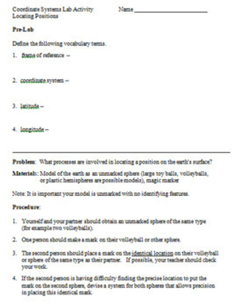
- Coordinate Systems Lab Activity (7 pp.)
- Learning Objectives (1 p.)
Learning Objectives
Upon the completion of this unit the student will be able to:
1. explain what is meant by a coordinate system.
2. define the terms latitude, longitude, parallel and meridian.
3. locate any position on the earth's surface using its latitude-longitude coordinates.
4. identify the latitude of the following; equator, tropic of cancer, tropic of capricorn, arctic circle, antarctic circle, north pole and south pole.
5. recognize the altitude of Polaris equals that latitude north of the equator of the observer.
6. define the term frame of reference and explain why a frame of reference is important.
7. recognize that the Prime Meridian serves as a frame of reference for determining longitude.
8. explain what is meant by solar noon.
9. explain why the earth's rotation rate is 15º/hour.
10. explain how to calculate your longitude if you know the time at your location and at the Prime Meridian.
11. explain what is meant by a field.
12. define the terms isoline, isotherm, isobar and contour line.
13. given the values in a field, properly construct isolines representing that field.
NGSS Standards: Content is a prerequisite for Earth science content.
NY Earth Science Core Curriculum: Standard 4, Performance Indicators 1.1 c, 1.1 d, 1.1 f
Terms of Use
Purchase of the product is for classroom use by the purchaser only. It is a violation for individuals, schools, and districts to redistribute or sell this item on the Internet or to other individuals. I do encourage you to use and edit these documents to suit your needs with your own students in distance learning environments.
This work is licensed under a Creative Commons Attribution-NonCommercial-ShareAlike 4.0 International License.


