Description
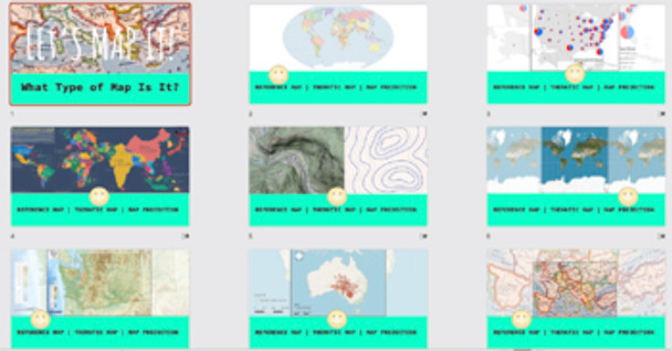
Students will become familiar with 11 maps and 4 map projections. This is an interactive notebook activity that students can use throughout the year to refer. It is suggested that students complete 3-4 per class period.
This is more than simply reading the maps, but asking questions that will have students become familiar with and be able to recognize and make connections. This lesson asks connection questions such as: What does the word "plat" mean? What do you think this is called a plat map? What does this map use to communicate information? Why would this map be referred to as a locator map?
If you wish, you could modify this lesson to be a carousel activity instead of an interactive notebook activity, placing the maps around the room and having students move from one station to the next. Modify to meet your students needs.
Reading Activity ............................................................... page 1
Political Map ..................................................................... page 2
Physical Map ..................................................................... page 3
Road Map .......................................................................... page 4
Plat Map .............................................................................. page 5
Locator Map ....................................................................... page 6
Choropleth Map ................................................................. page 7
Dot Distribution Map ........................................................ page 8
Graduated Symbol Map ................................................. page 9
Isoline Map ......................................................................... page 10
Cartogram Map.................................................................. page 11
Topographical Map .......................................................... page 12
Mercator Projection .......................................................... page 13
Robinson's Projection ....................................................... page 14
Goode's Interrupted Pojection ........................................ page 15
Peter's Projection ............................................................... page 16
MATERIALS:
o Let’s Map It PowerPoint (Included) + Technology to show PP and/or suggested videos.
o One notebook per student, composition notebooks work best (Will act as their interactive notebook)
o Glue, double-sided tape, colored pencils, scissors, and other needed art supplies.
o Title Page (Full page copy)
o Table of Content (Full page copy)
o Page 1 (Full page copy)
o Page 2-13 (2 per page to save paper & ink) If you have the capability to print full-page, do so.
o Page 14-15 (Full pages copies)
o Internet access and books on maps for reference.
INCLUDES:
o Introduction PowerPoint
o Reading Activity
o Table of Contents
o Student title page to decorate for the cover of the notebook.
o 15 pages of map interactive notebook activities.
o Grading checklist
This lesson is laid out to last 5 days but can be shortened to last 3-4 days.
Disclaimer:
One purchase is for the use of one teacher. If additional teachers would like to use this product, please purchase additional licenses.
Checkout Geography and Math Made Easy for more resources


