Description
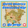
With this NO PREP worksheet activity your students will learn the physical geography of North America. Your students can use this GOOGLE DOC to work online or on paper. Organized, neat, and ready to print and go. Map included.
Your students will be labeling these items: (Copied from the student directions)
Outline the following countries on your map:
▪ United States (including Alaska): Red
▪ Canada: Green
Add the following water forms to your map and label them: (BLUE)
▪ Mississippi River
▪ St. Lawrence River
▪ Gulf of Mexico
▪ The Atlantic Ocean
▪ The Pacific Ocean
▪ Rio Grande River
▪ The Great Lakes
Add the following landforms to your map and label them.
▪ The Appalachian Mountains
▪ The Rocky Mountains
▪ The Great Plains
▪ The Coastal Plains
▪ The Great Basin
Label the following urban centers:
United States: *Washington D.C Chicago *New York City *Houston *Boston *Los Angeles
*Miami *New Orleans
CANADA: *Quebec *Toronto *Montreal *Vancouver (*port cities)
Include the following:
▪ Compass
▪ Legend
▪ Title
Label Jamestown Virginia and annotate its significance


