Description
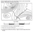
This zip file contains several different activities (37 pages of student handouts and a PowerPoint with a total of 27 slides) which can be used to compose a unit to teach topographic mapping. The learning objectives and specific contents of this set of materials is listed below. This set of activities is suited for many earth science, environmental science or physical science classes. With teacher guidance, many components in these materials are adaptable to an enriched middle level science curriculum.
All documents are in PowerPoint, word or pdf format to allow you to edit the documents to meet your needs. These documents are well suited for use in distance learning environments. Answer keys for all student activities are provided.
The specific contents of materials in the package are as follows:
- Topographic Map Completion Notes (12 pp.)
- PowerPoint to accompany the Completion Notes (27 slides)
- Making a Topographic Map Lab (3 pp.)
- Topographic Map Worksheet (9 pp.) (42 questions)
- Topographic Map Video Worksheet (requires internet access) (4 pp.) (22 questions)
- Topographic Map Quiz (9 pp.) (30 questions)
- Learning Objectives (1 p.)
Learning Objectives
Upon the completion of this unit the student will be able to:
1. describe several ways scales on topographic maps can be expressed.
2. state what is meant by different colors on a topographic map.
3. accurately calculate the distance between two points on a topographic map.
4. calculate the contour interval on an unmarked topographic map.
5. determine the elevation of every point on a topographic map.
6. determine the direction of flow of a river or stream on a topographic map.
7. determine the steepest slope of a hill or mountain on a topographic map.
8. calculate the gradient between two points on a topographic map.
9. determine the latitude and longitude of any point on a topographic map.
10. draw a profile between two points on a topographic map.
11. explain what is meant by magnetic declination and describe how it may be represented on a map.
NGSS Standards: Content is a prerequisite for Earth science content.
NY Earth Science Core Curriculum: Standard 4, Performance Indicators 2.1 q, Standard 6, Key Idea 3 and Standard 7, Key Idea 2
Terms of Use
Purchase of the product is for classroom use by the purchaser only. It is a violation for individuals, schools, and districts to redistribute or sell this item on the Internet or to other individuals. I do encourage you to use and edit these documents to suit your needs with your own students in distance learning environments.
This work is licensed under a Creative Commons Attribution-NonCommercial-ShareAlike 4.0 International License.


