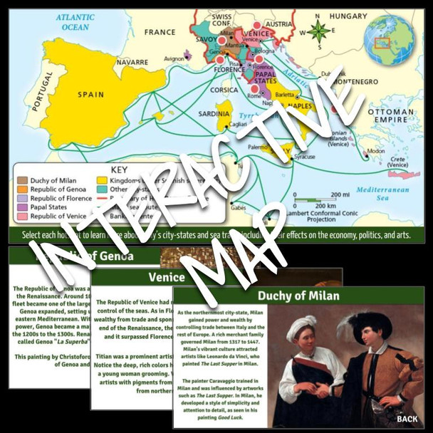
Interactive Map: Renaissance Italy's City-States
- Bulk Pricing:
- Buy in bulk and save
- Contributor:
- Tech that Teaches
- Grade Level:
- 6th to 11th
- Product Type:
- Interactive Map
- File Type:
- Pages:
- 11
- Answer Key:
- Yes
Description
This product is a Google form and doc linked to an interactive map on Italy's City-States during the Renaissance period.
The map shows political divisions in Europe and Italy around 1500. Unlike most of Europe, Italy was divided into city-states that were governed by powerful merchant families or the Church. Their wealth, used to sponsor artists, made the Renaissance possible.
Students can select the hot spots on the map learn more about the Italian city-states. Students will analyze the map and complete the 3 reading comprehension questions and 2 grids on the form. Students will answer the 3 short answer questions on the doc. This activity has worked very well in pairs. This is an enrichment activity.
Students will learn about:
- Venice
- Florence
- Milan
- Genoa
- Papal States
- Sea Trade Routes
This product is editable and option orders are shuffled.
Thank you for looking!
Visit my store for more great activities


